Navionics+
Navionics+ is the new electronic chart standard providing more content and the best value for marine areas and lakes for new customers.
Navionics+ is a preformatted card offering:
- 12 months of Freshest Data to Nautical Charts, SonarCharts™ and Community Edits
- Download content from within one of the available regions
- Ability to enhance charts with sonar logs upload feature
Dealer benefits:
- Easy to stock
- One preformatted card enables download of any region: customers needing non-stocked charts can buy Navionics+ and choose from any of the available regions
Customer benefits:
- SonarCharts™ layer
- Sonar logs upload feature for more accurate local SonarCharts™
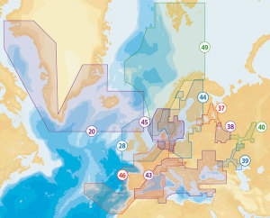
- Ability to choose coverage area from one of the available regions around the globe
- Flexibility to download the content they need
- 12 months of Freshest Data
- For North America: Navionics+ includes lakes and saltwater coverage all in one
- Attractive price
The Process:
- Customer buys Navionics+ from a dealer
- Customer plugs the card into a PC or Mac. MSD/SD cards can be plugged in using the dedicated computer slot or the card reader provided in the product packaging. CF cards require an external reader (to be purchased separately by customer). Internet connection is required. Navionics.com recognizes the card and automatically initiates the download process. If necessary, the customer may select “Downloads & Updates” from navionics.com and follow simple online instructions to initiate the download process
- Customer is prompted to select one of the many regions. The region selection is definitive and cannot be changed or combined
- Customer is prompted to choose the desired coverage area from within the region they chose. More coverage can be added from within that region anytime. When downloading, customer can choose to update the Nautical Charts, SonarCharts™, and Community Edits by flagging the content they want. Customers can upload sonar log recordings to enhance charts in their area anytime
Card max download available 2 GB. As an order of magnitude the Mediterranean basin is 1.1 GB ca and the US East Coast is 2 GB.
If you require further information regarding this product please call us on +31 (0)180 – 62 24 42 or send us an e-mail.


